Askewville-Colerain Tornado
The following is a map showing the general path of the Askewville-Colerain Tornado that hit Northeastern Bertie County last Saturday night. Following the map are pictures of around 50 to 55 of the destroyed buildings. 11 deaths is half of all the deaths in NC and a quarter of all the deaths in the nation. Hundreds were taken to the hospitals around the area, some in such critical shape that they are likely to add to the death toll.
One lady who was missing for most of Sunday was found 300 yards back in some woods, nearly a quater of a mile from where the tornado picked her up. We can only pray that she was dead before it lifted her up and carried her so far. The possiblity that she was alive is heartbreaking.
These pictures show barely half the destruction since many of the roads are still closed for restoration of electric power. While I was taking these pictures I saw more than 50 trucks replacing uprooted power poles and hanging power lines. The area is truly devastated. You can tell that from the pictures below.


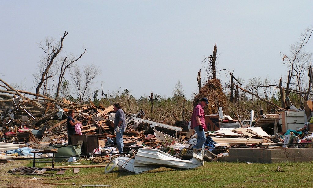


There were three roads that had significant tornado damage that were still closed when I went out to take photos. I will add pictures of the destruction on those roads as soon as they open up.
posted by Dean Stephens @ 1:19 PM
2 Comments
![]()
![]()

2 Comments:
Are you still composing the chowan patriot? I am one of. The survivors
I plan to start up again, but I have not posted much for the last year. My Mom is not doing well and I just don't have much time after taking care of her.
Post a Comment
Subscribe to Post Comments [Atom]
<< Home